More mangroves mean safer coastlines in times of duress and flooding. In Indonesia, which holds much of the world’s mangrove forest, The Nature Conservancy (TNC) has teamed up with the International Federation of the Red Cross (IFRC) to explicitly bring nature into the humanitarian cycle of preparedness, response and recovery. Using geospatial technology to help planners and decision-makers examine the potential role of mangroves in providing coastal protection, TNC can successfully integrate nature conservation and disaster management.
More mangroves mean safer coastlines in times of duress and flooding. In Indonesia, which holds much of the world’s mangrove forest, The Nature Conservancy (TNC) has teamed up with the International Federation of the Red Cross (IFRC) to explicitly bring nature into the humanitarian cycle of preparedness, response and recovery.
Using geo-spatial technology to help planners and decision-makers examine the potential role of mangroves in providing coastal protection, we can successfully integrate nature conservation and disaster management. With rising sea levels and climate change showing no sign of abatement, the Director of GDPC, the American Red Cross and the Global Disaster Preparedness Center (GDPC Omar Abou-Samra, Director says, “We need to stay relevant and progressive and think creatively rather than just doing things how we have always done them.”
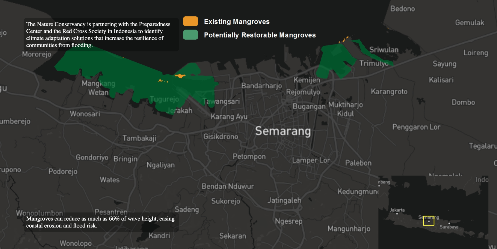
In a pilot project between TNC and GDPC in Semarang, Indonesia, Resilient Coastal Cities is intended to advance ecological resilience within the humanitarian cycle and build green approaches to disaster risk reduction. FloodTags from The Netherlands has developed online media monitoring and direct messaging support to map flood events which illustrate the connection between upstream and downstream impacts, as well as the magnitude and impact of floods. It also distributes historical as well as real-time flood reports derived from Twitter-based text locations. This algorithm was put together by TNC staff in Indonesia and divides incoming flood reports into ‘flood’, ‘flood related’, ‘mixed’, and ‘irrelevant’ classes. In this case, the geographical scope of the data was limited to the North Coast of Central Java which includes Semarang.
TNC also organized the data with relevant demographic, vulnerability, and ecosystem information for the city. The result is an app, call the Resilient Coastal Cities Explorer which helps planners and managers visualize opportunities for nature-based adaptation solutions that should help reduce flood risk in the future. In a nutshell, the ability to view potential adaptation and flood mitigation opportunities alongside flood risk enables key stakeholders to consider multiple solutions that will help make communities within Semarang more resilient to future flooding. Adaptation solutions were selected based on actions that are feasible in the region, namely mangrove restoration and open space reclamation/preservation. In addition to the database and web app, TNC has worked with Esri to build a 3-D model of possible mangrove restoration scenarios for Central Java.
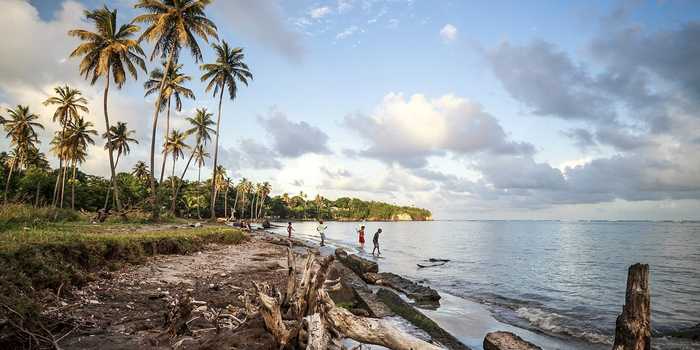
For the local Red Cross Society, demonstrating the relationship between coastal flood mapping and the identification of where mangroves could reduce risk in the city has provided a fresh perspective to disaster preparedness and recovery planning. Community and stakeholder engagement through tools like FloodTags also demonstrates how social-media derived information illustrates the vulnerability of critical infrastructure, while the restoration scenarios provide a view toward the future. As part of disaster preparation and management mangroves are a hero we ignore at our peril.