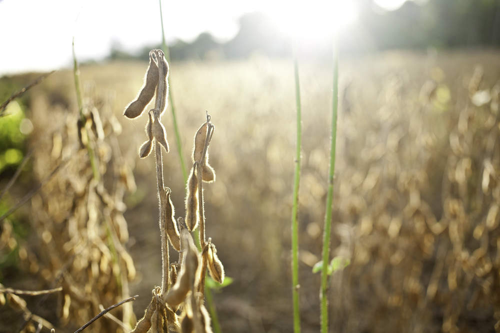
Soy is a valuable commodity and staple in global food supplies—but it also has a growing footprint on many landscapes. Agroideal is a new tool that helps farmers and businesses identify the best areas to plant soy to achieve minimal environmental and social impacts.
Soy is a valuable commodity and staple in global food supplies—but it also has a growing footprint on many landscapes. Agroideal is a new tool that helps farmers and businesses identify the best areas to plant soy to achieve minimal environmental and social impacts.
Global demand for soy is rising and production is expanding rapidly, making it one of the main causes for the destruction of natural ecosystems in Latin America. In Brazil, which grows about a third of the world’s soy bean crop, expanding soy production is in some places driving the deforestation of threatened ecosystems like the Amazon and the Cerrado, a unique, biologically rich savannah. These habitats are not only home to species found nowhere else in the world—they are also major carbon sinks, and their further development could hinder efforts to mitigate climate change.
Managing soy’s growth is crucial if we want to preserve these ecosystems. Soy is one of Brazil’s biggest commodities, generating raw and processed exports worth more than US$24 billion in 2016—much of that going to China, where it helps feed a population of 1.4 billion and contributes to a US$12 trillion economy. The challenge at hand is to find land where it’s possible to grow soybeans sustainably and keep forests intact, while simultaneously maximizing economic returns.
It’s not an impossible situation—but it does require that companies and farmers in Brazil have access to more and better economic, social, and environmental data. The newly expanded Agroideal, an online tool, is intended to fill this gap. Agroideal allows its users to generate a map of risk and sustainable opportunity exposure for a relevant region and then assess the threat of expansion over native vegetation. Users can incorporate this information into regional development strategies to plan expansion over land that has been previously cleared, reducing the conversion of natural areas and minimizing social and environmental impacts.
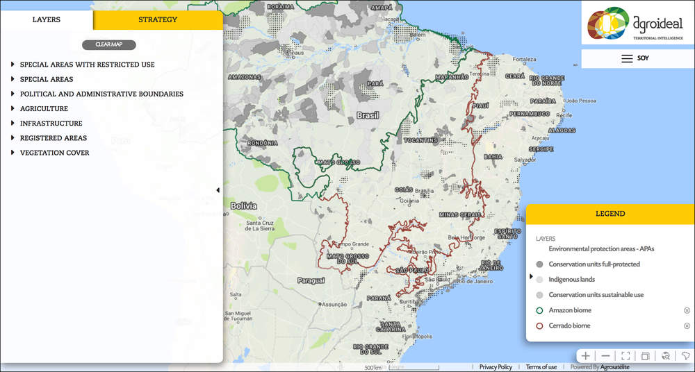
The Nature Conservancy, along with Bunge Limited and a coalition of other companies, NGOs, research organizations and government departments, launched the first version of Agroideal in September 2017 with data from the Cerrado region in Brazil. Located in Brazil’s central high plains region, the Cerrado covers approximately 25 percent of Brazil’s surface area. With over 10,000 species of plants – 45 percent of which are unique to the region – it is the world’s most biologically rich savanna.
“Agroideal puts information at your fingertips. The challenges in the Cerrado aren’t new, but smarter accessible tech allows for better approaches to farming practices. It’s critical in places like the Cerrado, a mosaic of cleared land and natural habitat, that we have Agroideal as a trusted source to tell us where to plant, and which areas to avoid,” said David Cleary, Director of Agriculture at The Nature Conservancy.
Agroideal focuses on agricultural frontiers and the expansion of soybean production. It allows participants in the soybean value chain to assess the risks and opportunities of development, enabling intelligent planning for growth on already open areas suitable for soybean production with potential for high productivity.
The tool allows users to integrate multiple data layers to create maps that show the relative opportunity and risk of agricultural expansion in specific regions. Users can incorporate this information into regional development strategies, directing investment into areas of higher agronomic potential and lower environmental risk. The result can be more production with reduced conversion of natural areas and positive social and environmental benefits.
Agroideal is an important part of implementing Bunge’s zero deforestation commitment. It gives Bunge new capability to integrate environmental considerations into our planning and sourcing decisions.
Stewart Lindsay, Vice President, Corporate Affairs, Bunge Limited
About the tool
- Developed by a coalition of 18 members – companies, NGOs, research organizations and government departments
- Single database, easy to access
- Free to use
- Multi-disciplinary, multi-sector approach to land use planning
- Combines quantitative, qualitative and spatial methods
- Based on sustainable development
New functionality
- Updated data from expanded regions
- Additional data layers
- Available in English, Portuguese and Spanish
New updates planned for later this year will include coverage of the Argentinian Chaco, where expansion is happening and the risk of deforestation is high. Moving into 2019, updates will focus on incorporating livestock mapping within the Cerrado, Amazon and the Paraguayan Chaco regions where cattle can graze and grow.